Androscoggin River Restoration
In 1972 Edmund Muskie, the senator for Maine at the time, helped draft and pass the Clean Water Act in 1972. He was inspired to ensure Americans have access to clean waters after growing up near the polluted Androscoggin River. Today parts of the Androscoggin River are still not up to the Clean Water Acts standards and work is still being done to clean its waters.
The Androscoggin River has been struggling with pollution from Pulp and Paper Mills. Pulp and Paper mills manufacturing processes have many harmful by-products, however dioxins are among the most potent toxic chemicals and can cause serious issues for ecosystem, food system, and human health. Dioxins are produced by the burning of chemicals containing chlorine. Incinerators and Paper mills are known to burn such chemicals. Dioxins are known to disrupt human’s hormonal, reproductive, and immune systems. They are also known to be endocrine disrupters, which are chemicals known to disrupt our hormonal systems by mimicking natural hormones in our bodies and blocking or disrupting them. If these chemicals get into a water source, it can cause great harm. The chemicals can be found in water, in animals, in soil, and in the air. Considering biomagnification, crops, fish, and livestock exposed to dioxins and consumed by humans can cause numerous health problems. Those at the highest risk are developing fetuses and nursing infants, and fish consumers.
In 2022 the Maine Legislature passed a bill to upgrade 800 miles of Maines waterways. This included some of the Androscoggin River. Additionally, the Natural Resource council of Maine has worked hard over the years to stop the pollution into the Androscoggin through advocacy, appeals, and lawsuits. In 2007 Natural Resource Council of Maine sued International Paper to take on their Mill in Jay, Maine and appeal their river discharge permit. Since cleaner technologies exist to reduce pollution and lower production costs, the Mill in Jay. Today much of the Androscoggin River is clean and safe to fish in and recreate, although there is still work to be done.
Skjern River Restoration
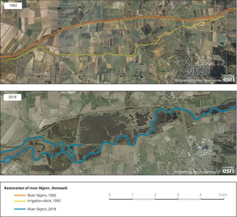
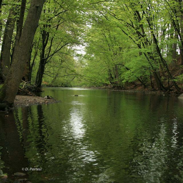
The Skjern River restoration project is one of the largest restoration projects in northern Europe at about 2,200 hectares in scale. The project aimed to return a river modified for agriculture and irrigation to its natural winding and meandering state. The Skjern River is in western Denmark on the Jutland peninsula and feeds into the Ringkobing Fjord.
In the 1960s the Skjern River’s natural shape was disfigured. It was straightened, deepened, and embanked. To convert the land for agricultural purposes, dikes and drainage channels were constructed to lower the groundwater level. The project sacrificed 4000 hectares of wetlands, meadows, and shrubland. The new prairie ecosystem and agriculture uses caused a myriad of issues. Floodwater no longer breached the banks, and pesticides were liberally used. The previous landscape was successful in sinking nutrients back into the ground, but now it acts as a channel to bring nutrients, and pollutants straight to the Ringkobing Fjord. Due to oxygen exposure, the peat-rich soil sank rending the constructed drainage ineffective. This caused the water to become filled with toxins to fish and other organisms and turn bright red.
Between 1999 and 2002 construction took place. Dikes were removed, old channels filled with soil, a new meandering river course was excavated bringing the length of the river to 26km (up from the straight 19 km). Multiple outflows were built creating a delta into Ringkobing Fjord approximately 220 hectares in size. In addition, construction and removal of old infrastructure, the plan was to allow natural flooding patterns to occur and allow riparian areas to reestablish. Some dikes were constructed to protect small towns along the river, but they were placed to ensure flooding only happens in the natural flooding area. The final phase of the project was completed in 2005 when facilities for the public, trails, and educational materials were implemented. The project was successful and these lands have become essential on migration routes for birds, the removal of dikes and dams have benefitted fish populations as they now can move freely. The groundwater level is no longer being lowered by pumping, so the leaching of ochre sediment in the project area has virtually stopped. At high water, floods inundate the surrounding meadows, depositing nutrients emitted by agriculture and aquaculture facilities. These substances are effectively filtered and prevented from entering Ringkobing Fjord, where they would have a negative impact on the fjord environment and the fishing industry. The project area now offers ideal conditions for flora and fauna and has already acquired great natural value. In fact, it has already grown into a bird site of national importance. Birds began arriving by the thousands almost as soon as the excavators left the area. Since then, no fewer than 212 different bird species have been registered in the area, and more are being added to the list all the time. The new natural area is an important staging post for many bird species on their way between their winter quarters in Southern Europe and Africa and their breeding grounds in the north and east.
Wet Woods LIFE Project to Restore Bog, Woodland, and Residual Alluvial Forest
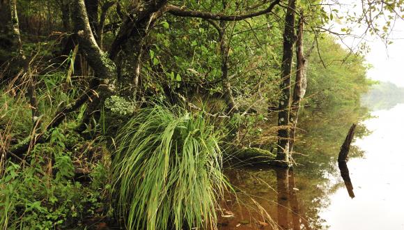
The Wet Woods LIFE conservation project was an initiative funded by the European Union’s LIFE Nature Program that took place between 1998 and 2002. The goal of the project was to some of the most important wetland, bog, and floodplain ecosystems in the UK. The project generally included removal of non-native trees, thinning of Scots Pine, and damming of drainage canals altering hydrological conditions.
The problem the Wet Woods LIFE project is looking to address is issues relating to degradation of the hydrological system due to human land-uses which in turn has impacted ecosystem health and water quality negatively. Fertile lands where alluvial forests once stood have been cleared for agriculture and grazing, upstream drainage has impacted essential seasonal flooding patterns in turn making water quality worse. Additionally, non-native trees have displaced native vegetation and have led to the decline of Wet Woods.
Restoring wetland habitats by reinstating natural hydrological systems, restructuring plantation forests, creating riparian buffer zones of native woodlands, removal and control of non-native trees, employing remote sensing strategies and research to inform restoration, monitoring and management of wetlands are all strategies that were used in this project. Additionally, educating local organizations and communities on wetland conservation, and partnering with landowners helped ensure this project is not forgotten. The project was successful, and today no areas need major remediation work. Monitoring continues, and relationships continue to be strengthened in the communities between landowners, conservation organizations, and municipalities.
The Restoration of an Urban Floodplain in Rahway, New Jersey
The Rahway River Watershed is a highly urbanized watershed, and one of the longest continuously urbanized watersheds in New Jersey. Between 1994 and 2005 a remediation project took place to restore the Rahway River floodplain and create a corridor to be included into the Union County Parks System as a Wetlands Observation Area to restore hydrological function, minimize flooding, create public access, provide water retention and filter out pollutants.
Due to the long history of land use and modification by humans, the watershed has essentially lost its ability to function properly. The development of the area has led to flooding that causes damage to homes and businesses in the area.
By looking at historical accounts and maps of the watershed, planners decided to interpret and adapt their plans to match the original function as well as they can. The main goal of this project is to restore the floodplain to its predevelopment condition. To restore the floodplain, it must provide wetland mitigation, enhance and expand wildlife habitat and green space within the urban area.
Each of these projects met their goals by employing conservation strategies such as restoring riparian buffers, researching historical function of the watershed to understand how long-affected watersheds functioned prior to anthropogenic modification of the landscape, and creating a coalition of stakeholders including communities, local and regional government, and conservation organizations. Additionally, infrastructure, policy, and monitoring of the project areas were employed.
Through a deep understanding how natural hydrological function works, and why it is important to restore and conserve it watersheds around the world can provide clean water, mitigate flooding, and countless other invaluable benefits to nature and humankind.